Water Balance of Northern Kazakhstan's Water Management Basins
estimated using Remote Sensing, Global Datasets, and Hydrological Information.
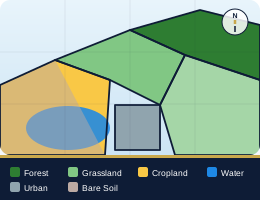
Land Use and Land Cover with boundary spatial layers for Kazakhstan watersheds.
Explore MapInteractive WebGIS with charts of precipitation, evapotranspiration, and soil moisture.
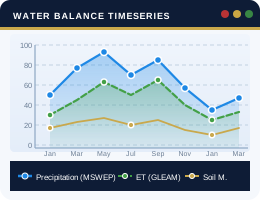
Explore TimeseriesJupyter Notebook visualization of water use and abstraction analysis across basins.
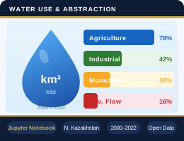
Explore NotebookThis portal provides spatial data on watershed basins and water management basin boundaries as part of the project "Water Balance of Northern Kazakhstan's Water Management Basins Estimated Using Remote Sensing, Global Datasets, and Hydrological Information." It was developed with grant funding from the Ministry of Science and Higher Education of the Republic of Kazakhstan. Learn more at the project page.
Available datasets include spatial and time-series information for hydrological analysis in Northern Kazakhstan. They cover vector layers such as watersheds, basins, sub-basins, hydrological regions, rivers, and lakes, as well as 100-m ESA WorldCover land-cover data. Time-series datasets provide monthly precipitation (MSWEP), soil moisture (ERA5), and water-balance indicators (GLEAM), aggregated at the basin level. All datasets are offered in multiple formats — GeoJSON, GeoPackage, Shapefile, GeoTIFF, JSON, CSV, and Excel — for seamless use in GIS platforms, modeling workflows, and visualization tools.
Open datasets and peer-reviewed research produced by the WaterBalance Kazakhstan project team.
The watershed boundaries of large river and water management basins of Kazakhstan
Shapefiles of 14 watershed and water management basin boundaries for Kazakhstan and Central Asia, with multiple projection formats for GIS analysis and visualisation.
Open Dataset ↗Baseline information and regionalization of the large river basins of Kazakhstan
Categorises Kazakhstan's river basins into Northern and Southern hydrological regions based on hydroclimatological characteristics, bioclimatic zones, and water balance components.
Read Paper ↗Examines 1981–2019 climate trends across two Kazakh regions, identifying groundwater recharge capacity (~28% north, ~24% south) and recommending managed aquifer recharge to address seasonal water scarcity.
Read Paper ↗For inquiries, please contact the project manager: vyapiyev@nu.edu.kz